Category:Maps of Bordeaux
Jump to navigation
Jump to search
Wikimedia category | |||||
| Upload media | |||||
| Instance of | |||||
|---|---|---|---|---|---|
| Category combines topics | |||||
| Bordeaux | |||||
city and commune in Gironde, New Aquitaine, France  .svg) .svg)  | |||||
| Instance of | |||||
| Industry |
| ||||
| Location |
| ||||
| Located in or next to body of water | |||||
| Head of government |
| ||||
| Inception |
| ||||
| Significant event |
| ||||
| Population |
| ||||
| Area |
| ||||
| Elevation above sea level |
| ||||
| Different from | |||||
| official website | |||||
 | |||||
Subcategories
This category has the following 12 subcategories, out of 12 total.
A
- Attraction maps of Bordeaux (3 F)
E
- Ecological maps of Bordeaux (2 F)
G
- Geological maps of Bordeaux (1 F)
H
L
- Locator maps of Bordeaux (4 F)
M
O
- Old maps of Bordeaux (77 F)
P
T
Media in category "Maps of Bordeaux"
The following 21 files are in this category, out of 21 total.
-
 Bor-dotmap.jpg 786 × 792; 103 KB
-
 33063-Bordeaux-Routes-Hydro.png 3,507 × 2,480; 11.31 MB
-
 33063-Bordeaux-Sols.png 3,270 × 2,598; 11.14 MB
-
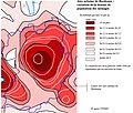 Bdx Air Urb variation densite.jpg 844 × 717; 155 KB
-
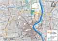
 Bordeaux Boulevards New.png 812 × 844; 206 KB
-
 Bordeaux Boulevards.png 812 × 844; 202 KB
-
 Bordeaux gare St Jean.png 1,053 × 1,427; 244 KB
-
 Bordeaux kaartje 2.JPG 750 × 550; 54 KB
-
 Bordeaux kaartje.JPG 750 × 550; 51 KB
-
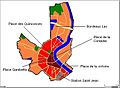
 Bordeaux Quinconces.png 1,053 × 1,427; 246 KB
-
 Bordeaux wine region.png 597 × 450; 58 KB
-
 Bordeaux-plan-ville.png 750 × 550; 8 KB
-
 Bordeaux.JPG 750 × 550; 55 KB
-
 Carte bordeaux.png 535 × 547; 40 KB
-
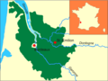
 Gironde-Bordeaux.jpg 479 × 370; 46 KB
-
 Map commune FR insee code 33063.png 756 × 605; 140 KB
-
 Palais Gallien Cadastre.jpg 581 × 559; 107 KB
-
 Plan Bordeaux.png 2,085 × 2,606; 1.39 MB
-
 Plan Parcs et Jardins de Bordeaux.png 800 × 1,000; 668 KB
-
 Périmètre Unesco Bordeaux Port de la Lune.gif 848 × 1,200; 682 KB
-
 Topographie de bordeaux.jpg 1,280 × 1,280; 210 KB


